
Vrbas: A River That Shapes Landscapes and the Rhythm of Life
![[object Object]](https://api.hedonistmagazine.net/storage/images/2026/05/1118286e-1c7b-4a0b-858c-24449d732bf4.webp)
If there is a river that can change its character several times within just a few hours, more than some cities do in a century, it is the Vrbas. Fast, wild, quiet, then gentle again - all within a single flow. It begins as a mountain stream carving through rock, and ends as a calm river nourishing the plains. Between those two points, the Vrbas draws landscapes that stay with you.
Its journey begins high, almost hidden, on the slopes of Mount Zec, part of the Vranica massif, at an elevation of over 1,700 meters above sea level. From that quiet source, the Vrbas sets off on a journey of about 250 kilometers, descending through mountains, cutting through rock, widening valleys, and finally calming into the plains before flowing into the Sava River.
But the Vrbas is not just a river. It is a line that connects landscapes, cities, and stories.
A River That Changes Its Face
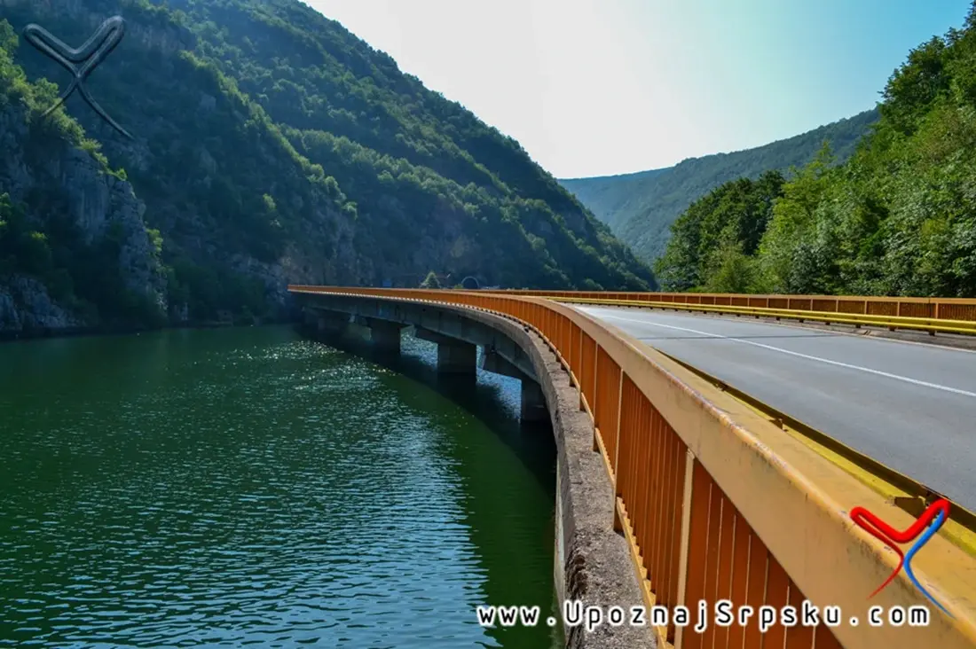
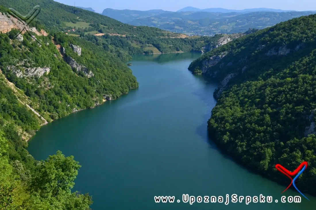
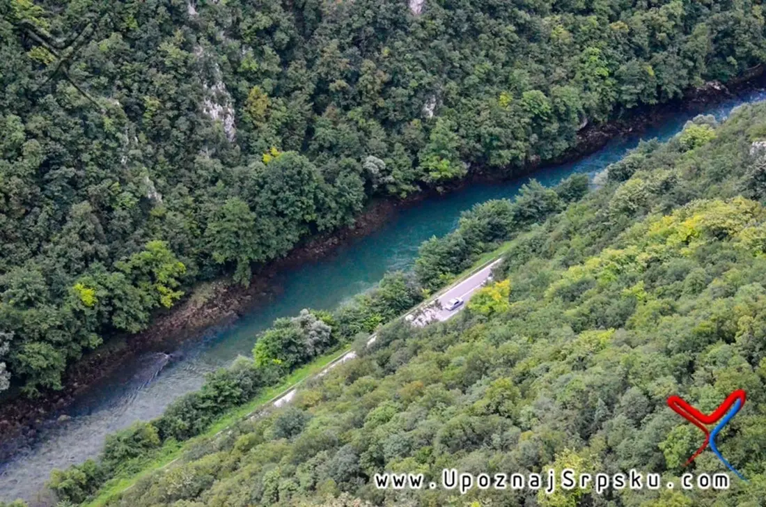
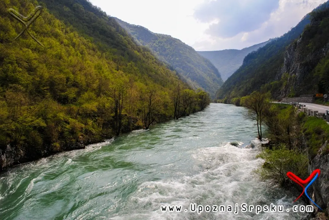
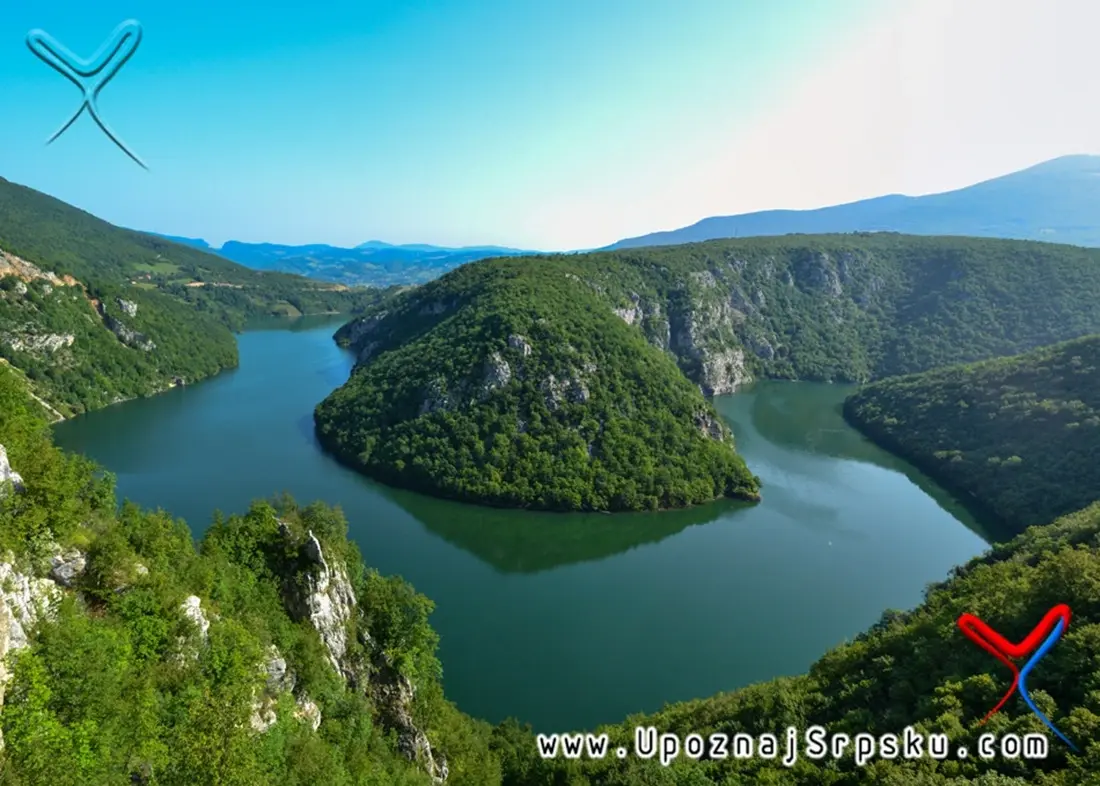
In its upper course, the Vrbas is a typical mountain river - fast, cold, and restless. It passes through narrow gorges such as the Vinačka Gorge and the Tijesno Canyon, where cliffs nearly close the horizon and the water forces its way through with a power you can feel without touching it.
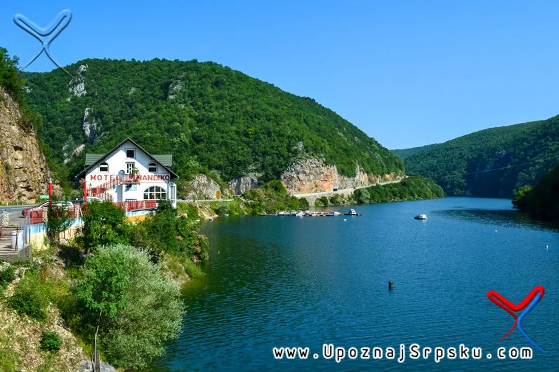
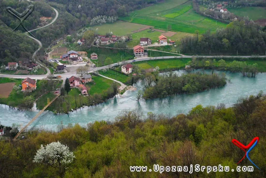
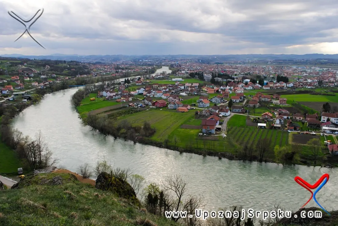
As it descends, the landscape shifts. The river widens, enters valleys, and forms spaces that have long served as natural crossroads - Skopalj and Jajce basins, followed by the Banja Luka basin.
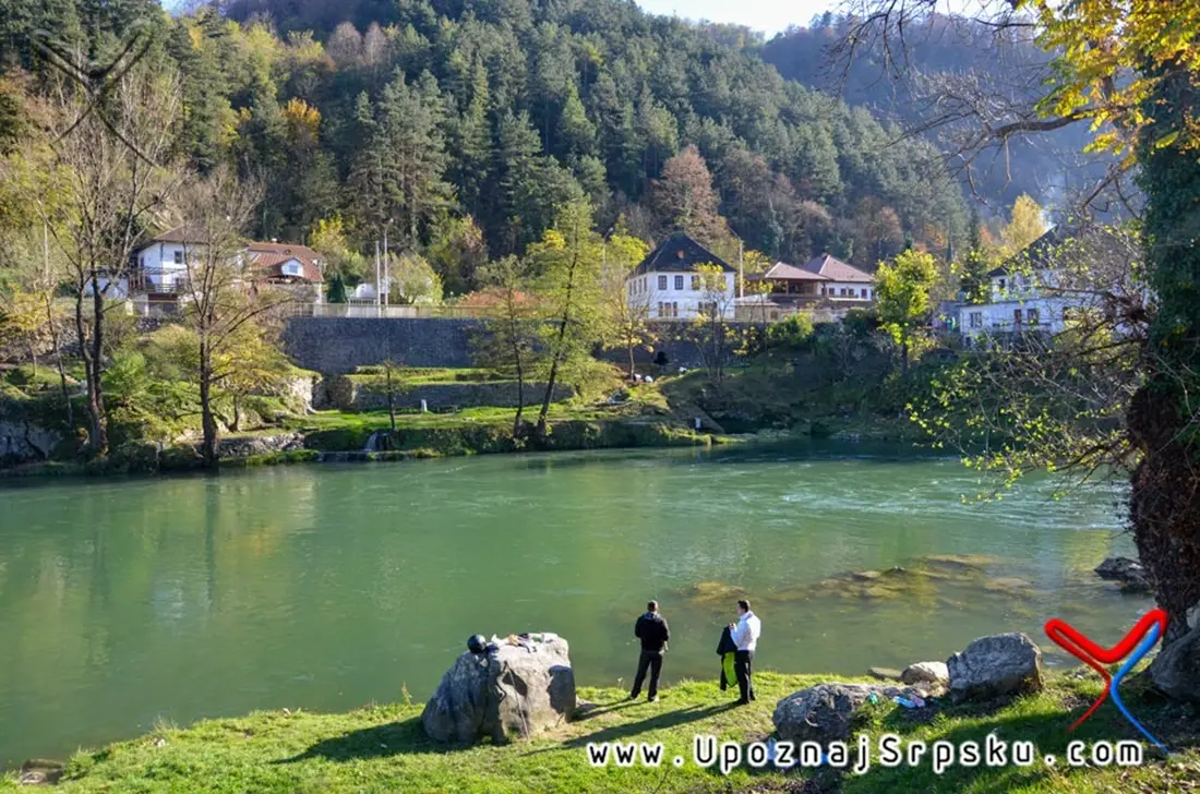
After Banja Luka, the Vrbas slows down. It becomes a lowland river, quieter, wider, almost calm, as it creates the fertile Lijevče Field, now known as one of the most important agricultural areas in this part of Republika Srpska.
Cities Along the Water
Today, more than half a million people live along the Vrbas. Cities such as Gornji Vakuf, Bugojno, Donji Vakuf, Jajce, and Banja Luka are not randomly placed along its course - they exist because of it.
Banja Luka, in particular, grew directly along the river. Here, the Vrbas is more than a natural feature - it is part of the city’s identity, a place for gathering, recreation, and everyday life.
It is no coincidence that during the Yugoslav era, there was a region called the Vrbas Banovina, named after this very river. That alone speaks to its importance.
A Natural Spectacle in the Heart of Jajce
One of the most unusual sights along the Vrbas is found in Jajce, where the Pliva River flows into it through a waterfall - right in the center of the town.
Such a scene is rare even on a global scale: the meeting of two rivers, a vertical cascade, and a historic urban backdrop. It is a moment where nature and architecture do not stand in contrast, but function as a single stage.
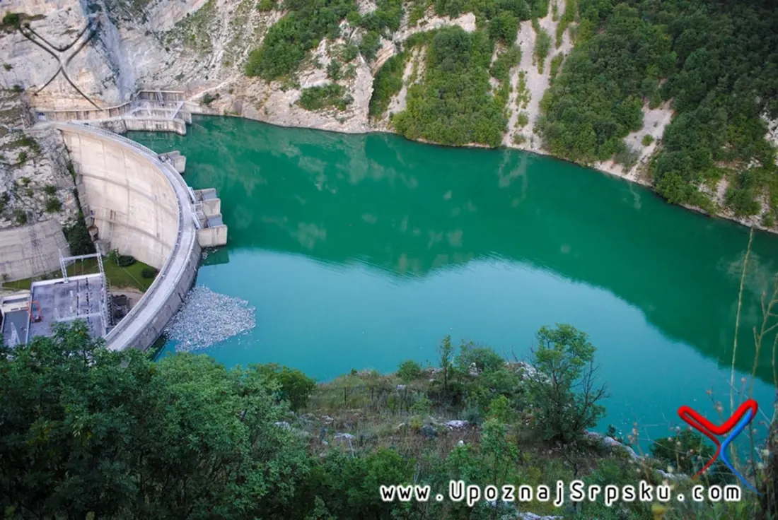
Between Energy and Stillness
The Vrbas is a river of contrasts. In one part of its course, it offers raw energy - rapids, rocks, and challenges for rafting, kayaking, and canoeing. Thanks to these conditions, Banja Luka has hosted world and European rafting championships.
In another part, the Vrbas becomes a place of quiet. A setting for fishing, walking, and simply being in nature. Its waters are home to more than 20 species of fish - from trout and grayling in the upper course to carp and catfish in the lowlands.
It is a river that offers both adrenaline and calm, depending on what you are looking for.
Layers of History Along the Flow
The Vrbas valley has always been an important route of movement - roads connecting central Bosnia with the northern plains passed through here. Traces of that history remain visible in old towns and fortresses: Jajce, Bočac, Greben, Zvečaj, and Kastel.
Each of these places tells its own version of the same story - of a region that has always mattered, but has never been simple.
A River That Demands Attention
Like many rivers in the region, the Vrbas went through a period of intense industrialization in the 20th century, which left a mark on its ecosystem. Although much of that industry is no longer active, the pressure of urban development remains.
Today, however, increasing attention is being given to its protection and preservation. Local initiatives, along with platforms such as “Upoznaj Srpsku,” whose photographs accompany this story, are working to present the Vrbas not only as a natural resource, but as an experience - a place worth discovering and preserving.
Hedonism by the River
The Vrbas is not a postcard in the traditional sense. It is not always “neat” nor perfectly shaped for tourism. But that is precisely where its value lies.
It is a river that asks to be experienced - through a boat ride, a walk along its banks, a view from a fortress, or simply sitting by the water.
In a world that often seeks spectacle, the Vrbas offers something else: authenticity. And that may be the greatest luxury of all.
Related articles
Una: The One and Only – A River Made for Enjoyment
More than 2,000 years ago, according to legend, a weary Roman soldier, after countless battles, came upon an emerald river and, struck by its beauty, exclaimed: “Una!” One, the only one, the most beautiful among rivers. To this day, the Una carries that unique name.
Sutjeska: Raw, Wondrous, Wild
Sutjeska National Park is the oldest and largest national park in Bosnia and Herzegovina, home to one of the last primeval forests in Europe, a place of adventure, and a natural gem of Republika Srpska. The highest peak, Maglić (2,386 m), is also located within the park, making it the highest point in the country.